Caminos de Pasión GR 341 trail is completely signposted along its 320 km. The track of this trail corresponds to the track for the MBT bicycle route.
The tracks for the road and gravel bicycle route are slightly different to the GR trail tracks, therefore we advise to download them from our official Wikiloc and Komoot pages (both free apps).
Despite the signage placed along the trail’s entire route, as well as at the entrance and exit of towns, some signs may have disappeared due to weather conditions, accidents, vandalism, tall grass, or work performed with agricultural machinery. For this reason, it is highly advisable to download and use the tracks.
If you encounter any difficulties at any point along the trail, please send us a message at info@caminosdepasion.com and we will try to solve them in the shortest possible time.
Typer of signs
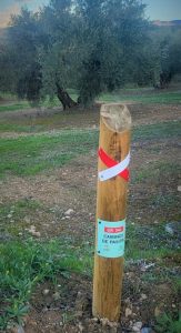
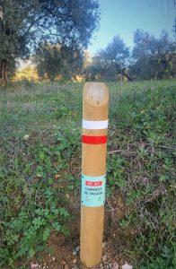
- White and red bands. This sign indicates that you are on a trail approved by the Andalusian Mountaineering Federation as Grande Randonnée Footpath (GR). The Caminos de Pasión path has its own GR: Number 341. These signs indicate the direction of the trail (two parallel rectangles placed horizontally), the wrong way sign (cross sign, St. Andrew’s cross) and the direction change sign (parallel lines 1 cm apart placed in an angle imitating a turn in the path).
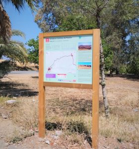
- Stage start panels. They include, among other information, technical data, a map of the stage, information on the natural resources found within each stage and recommendations for the hiker.
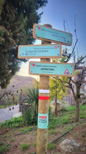
- Directional sign. These posts indicate the direction to follow and contain information about the distance, the town and time needed for the trail.
- Markers. They indicate that you are on the GR 341 trail. The two bands or stripes of color indicate the type of trail you are on.
- Danger warning sign.
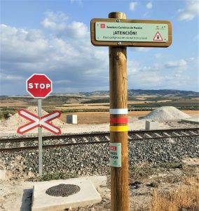
- Notice sign.
Cycle tourism signage
- MTB:Cyclists can follow the complete route with the signage available. This route has a maximum of 20% road sections. Download the track here.
- Gravel:Cyclists can follow 80% of the GR 341 trail by bike, except those stages that present greater difficulty, where other options are proposed.
- Road:Cyclists will be able to make their journey directly through the network of regional roads that connect the trail. Download the track here.
Hiking signage
The trail is prepared to be done completely on foot.
Horseback signage
All the stages of the trail can be done on horseback, except for stage 1, which is more difficult.


