 English
 Español
 Français
 Deutsch


Access to this trail starts from a fork to the left on the CO-751 road next to a small sign to signpost Povedano bridge. From this point, we enter a country lane which descends with bends and can be done on foot, bike or by vehicle (500m from the start of this earth track, there is a farmhouse with a flat area of land where you can leave your vehicle). A few metres further on, we find a small waterwheel, and then, on our right there is a farmhouse. The entire trail takes us through an area of olive groves with gentle hills that rise and fall, and beautiful views of the Sierra de Aras mountain range.
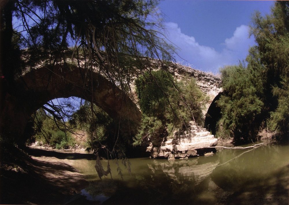
We will continue to head right, always along an earth track, and following the course of the Anzur river until we reach Povedano bridge. If we want to, we can climb the same path a little further and take in the views of this 16th century bridge until reaching the Sordillo well. This trail ends here, returning by the same route back to the starting point.
This bridge enabled travellers heading to or departing from Lucena to cross the Anzur river at this point. The first attempt to build this bridge took place in 1583, under the instructions of Hernán Ruiz III, but it wasn’t until 1589 that the work restarted.
The economic situation of municipal funds halted construction of the bridge at various times, causing Hernán Ruiz III to subcontract the work in 1595 to local stonemason, Marcos Jiménez and master Alonso González. Later, in 1602, the work was also handed over to a new master, Cristóbal Jiménez. Various attempts followed, but the works were not completed until 1622.
Photography: Miguel Cantero Sabán/ Miguel A. Cabeza.
Address
Address:
Lucena, córdoba
GPS:
37.407934060378, -4.4885268677684